
us-roads
July 10, 2013
With much thanks to and help from Mike Bostock, today I released us-roads; a project to create a TopoJSON file of all the roads in the US.
I learned Make from Mike Bostock’s great post Why Use Make. As he recommends, I now use Make to do a lot of the initial data gathering and processing in most of my AxisPhilly projects. Here’s an example from our When it rains project. The Makefile retrieves and processes all the data needed to make the rain gage map used in the story.
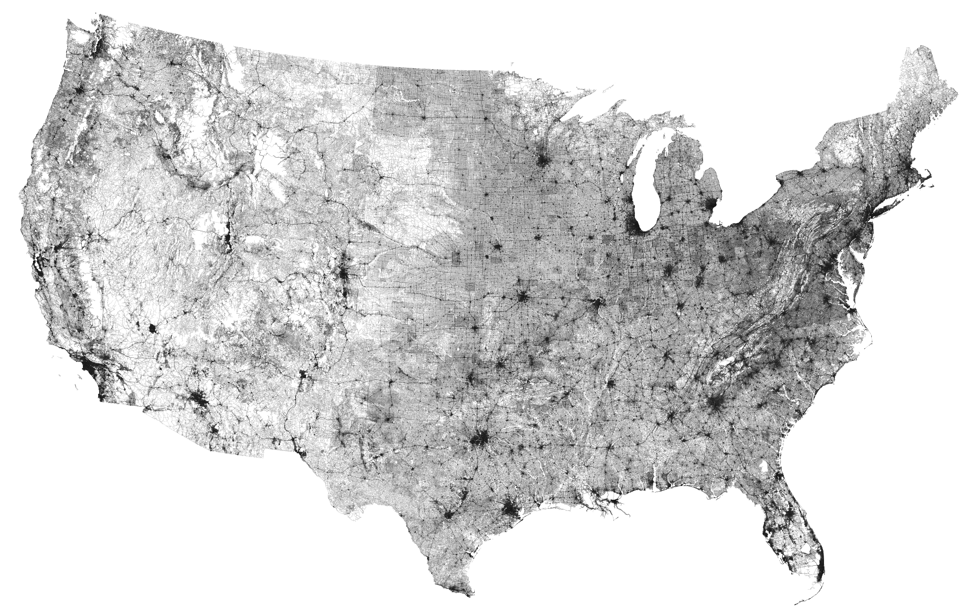
The project was featured, along with Mike Bostock’s us-rivers (the inspiration, and essentially what this project is a fork of), on FlowingData.